
Another one: Massachusetts braces for ‘powerful storm’ that could spark flooding, power outages
Maybe it’s Old Man Winter crying and howling because Bill Belichick is leaving.
The precipitation just won’t quit this week, as the next storm is set to blast the region from Friday night into Saturday. The potent system will be the third storm to hit the Bay State within a week.
The intense storm with heavy rain is expected to spark more river flooding. Forecasters are also predicting strong winds and coastal flooding.
“It looks like a fairly powerful storm,” Andy Nash, meteorologist at the National Weather Service’s Boston office, told the Herald on Thursday.
“The intensity should be pretty similar to what we had a couple days ago,” Nash added. “They’re not identical (storms), but they’re both on the intense side.”
The heaviest rain and strongest winds should be early Saturday between 3 and 9 a.m.
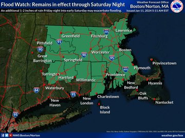
Meteorologists are predicting between 1 to 2 inches of rain, which would be less than the midweek rain storm when nearly 5 inches of rain fell in spots.
“The rivers are already running way higher because of the previous storm,” Nash said. “We could see similar flooding issues that we saw during the last few days.”
Related Articles
Here comes Round 3: Massachusetts will get hit by another ‘strong storm’ after nor’easter and major flooding
Avalanche kills 1, injures 3 at California ski resort that once hosted Winter Olympics
‘Strong’ storm to rip through Massachusetts after nor’easter: Flooding, power outages, damaging winds possible
Weekend snow could combine with rain and cause flooding midweek, NWS says
First snow storm of 2024 leaves tens of thousands without power
The National Weather Service has extended a “Flood Watch” through Saturday evening for the region. Those living in areas prone to flooding should be prepared to take action if flooding develops.
“If you’re out and about, never drive into water,” Nash said. “You don’t know how deep it is.
“Turn around, don’t drown,” he added.
There’s also a “Coastal Flood Watch” in effect for Saturday. Minor coastal flooding could occur along Morrissey Boulevard in Boston, along the North Shore from Gloucester to Newburyport, and along the Cape and Islands.
Wave action will likely cause some washover onto coastal roads around the time of high tide.
A “High Wind Watch” will also be in effect. Gusts up to 60 mph will be possible. Damaging winds could blow down trees and power lines.
“Some power outages could happen,” Nash said. “People should be prepared in case they lose power.”
After temps spike into the 50s on Saturday during the storm, colder air will be on the way. Low temps on Saturday night will be in the 20s to lower 30s. High temps on Sunday should be in the mid to upper 30s. Windy conditions are expected to stick around through Sunday.


More Stories
Meta accused of profiting from scams targeting US retirees
Advocacy groups have urged Congress to investigate claims that the tech giant benefited from fraudulent campaigns aimed at seniors Several...
Coverd and Albert Wang: Why the Next Chapter of Credit Card Rewards May Be Written Around Everyday Spending
The modern loyalty program occupies a curious place on corporate balance sheets, recorded as a liability that many issuers quietly...
What to Expect from UK Software Development Firms
In all industries, companies are making efforts to adopt digital solutions, automate processes, migrate to the cloud, and operate with...
Austen Hacker: From Concert Pianist to Pharmacy Leader
Success does not always follow a straight line, for Austen Hacker, the path to leadership in pharmacy began behind a...
Jonny Dodge: The Superyacht Influencer and Questions Over Mother City Capital
He has been called the “Superyacht Influencer” by Forbes, featured in Bloomberg, GQ, Tatler and Robb Report, and commands a...
6 Steps to Prepare for Making Tax Digital for Income Tax
Making Tax Digital (MTD) was first introduced by HM Revenue and Customs as part of a wider plan to modernise...