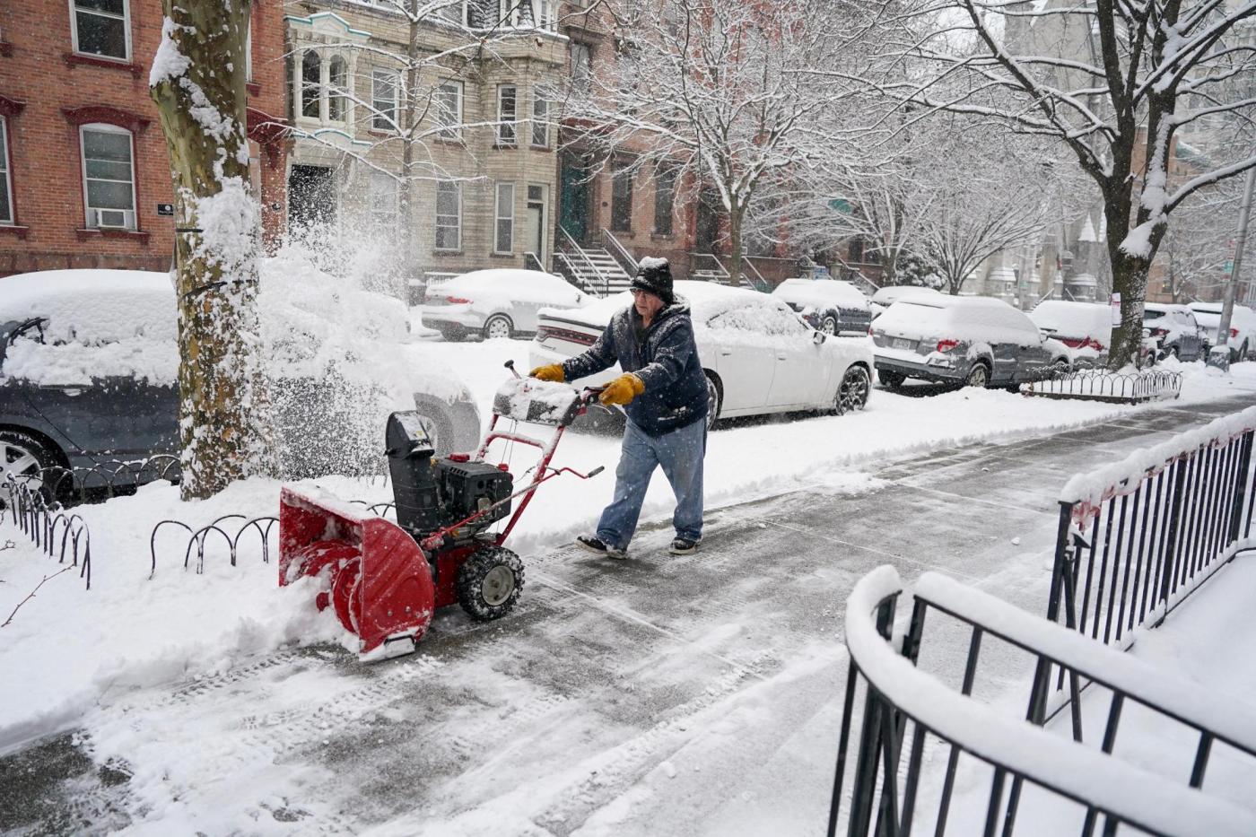
Winter storm hits Northeast, bringing foot of snow to areas
The first major storm of the winter season dropped more than 1 foot of snow in parts of the Northeast on Saturday, creating treacherous travel conditions in some areas while also bringing an end to a mostly snowless winter so far.
Heavy to moderate snow was expected to continue to fall over New York and New England on Sunday before dwindling by Monday morning, forecasters said.
More than 15 million people from the northeastern United States to Northern Arizona were under winter storm warnings Sunday.
Preliminary snowfall totals through Sunday morning were above 6 inches in many areas of the Northeast and reached or exceeded 1 foot in parts of Massachusetts, New York and Pennsylvania.
The National Weather Service warned that the “rapidly strengthening” storm would continue to disrupt travel. Forecasters warned of low visibility and dangerous driving conditions during the heaviest snowfall, which could reach 1 to 2 inches per hour.
More than 700 flights were canceled in the United States as of Sunday, according to FlightAware, a flight tracking service. As of 12:30 p.m., nearly 150 flights to and from Boston Logan International Airport had been canceled.
Amtrak service was modified on the Northeast Regional and Acela routes.
Power outages affected thousands of residents across the Northeast. As of Sunday afternoon, more than 17,000 customers were without power in Massachusetts and more than 2,400 customers in Pennsylvania had lost power, according to PowerOutage.us, which tracks the utility industry.
After an unseasonably warm December, the first snow of 2024 was greeted with a sense of relief, at least by Jesse Floyd, 57, of Boxborough, Massachusetts.
“New England winters should include snow,” he said. “It’s been too long since the last big storm. I can’t wait to get out and do some snowshoeing.”
Walter Lark, 35, and his son Ira, 3, enjoyed the slushy snowfall as they walked through the College Hill neighborhood of Providence, Rhode Island.
“My tongue is freezing,” Ira said, clutching and biting into a compact snowball. Asked if the snowball snack in his hand was tasty, Ira’s eyes lit up and he answered with a satisfied “Mhmm!”
Lark though said he was disappointed in the paltry showing of snow. “I was hoping for more snow because it’s fun,” he said.
Before the storm, residents scrambled for snow-removal supplies and officials discouraged travel. For several days, officials and forecasters in the Northeast had warned of dangerous conditions, with the region getting either heavy snow, freezing rain or a mix of the two.
As of Sunday morning, the weather service office in New York reported two-tenths of an inch of snow had fallen in Central Park, though some outlying suburbs got 4 or more inches. It has been almost 700 days since Central Park last received 1 inch of snow on a single day.
Gov. Kathy Hochul of New York said at a news conference Sunday that there was a threat of coastal flooding in the New York City area, especially on Long Island and in southern Westchester County, the Bronx and Northern Queens.
“I know our friends in New York City were waiting 693 days to be able to build a snowman, lucky for them, or unfortunately for them, depending on your perspective, they are going to have to wait a little longer,” she said.
The governor said that the most snowfall in the state so far was recorded in Ulster County, with 14 inches.
The fresh snow was especially welcome at West Mountain ski center, in Queensbury, New York, 20 miles north of Saratoga Springs. There hasn’t been a spot of snow on lawns the past few weeks and business was down 80% during the holidays, said Spencer Montgomery, the ski center’s co-owner.
The main benefit of Sunday’s fresh snowfall was to get people thinking about skiing, he said.
“It’s like running a restaurant and society’s lost their appetite,” Montgomery said. “That’s what the natural snow does. It makes people hungry.”
Before the storm, the director of the Maine Emergency Management Agency, Pete Rogers, warned residents to consider changing their travel plans.
“Make sure your vehicle is in good working order before you hit the road and that you have an emergency car kit and supplies handy, should you need them,” he said.
In Connecticut, the Division of Emergency Management and Homeland Security asked residents Sunday to stay off the roads until they had been cleared.
An upcoming storm system is expected to be stronger and have much more widespread effects.
It is expected to intensify into a dynamic storm that will produce heavy snow and strong winds over the Plains and Midwest Monday and Tuesday — with blizzard conditions possible and up to 1 foot of snow in some areas.
Excessive rainfall from this system is likely early in the week from Texas to the Northeast, increasing the chances of floods. Forecasters said significant river flooding was likely from northern Delaware through the Philadelphia area and across much of New Jersey.
And yet another winter storm is expected to arrive in the Pacific Northwest, producing heavy rain along the Pacific Coast and several feet of snow in the Cascade Mountains in Washington and Oregon.
Related Articles
1 dead after ATV breaks through ice on northern Minnesota lake
Ice assessment team formed to decide when Upper Red Lake will reopen for ice fishing
Another day, another northern Minnesota ice rescue: This time, 50 stranded anglers brought to shore
It’s official: Minnesota, Twin Cities experienced the warmest December on record
Upper Red Lake vehicle restrictions issued after recent incidents on poor ice


