
Massachusetts faced wildfire smoke, tornadoes, relentless rain, flooding, and more in ‘very active’ year
One of the grossest weather years in recent history is finally in the rearview.
Some of the most memorable weather events that impacted the Bay State in 2023 included nasty wildfire smoke, several tornadoes, and relentless rain throughout the summer that sparked major flooding.
Parts of Massachusetts even had to shovel out from more than 3 feet of snow after a whopper of a mid-March nor’easter.
The most unusual weather of the year was the smoke from the Canadian wildfires, which caused the air quality to plummet across the region. The hazardous haze and smoke impacted the area at times for many weeks because the remote wildfires were out of control.
“During the summer, we got caught in a persistent pattern where we had winds coming out of Canada, bringing that smoke into the area,” Bill Leatham, meteorologist at the National Weather Service’s Boston office, told the Herald this week.
While the wildfire smoke was a major story of the summer, so was the rain that never seemed to go away.
It was the second wettest summer in Boston recorded history, with 20.33 inches of rain. A normal summer in the city is 10.39 inches of rain.
In Worcester, it was the fifth wettest year in the city’s history. Worcester recorded 63.1 inches of rain for the year, which was 15 inches more than normal.
July was extremely wet, with several flash flood and severe weather events. On July 16, for instance, thunderstorms produced flash flooding across much of southern New England and a few instances of wind damage, including a tornado in North Brookfield.
In eastern Massachusetts, rainfall totals of 2 to 3 inches fell within an hour. Videos went viral of rain flowing down the steps in Fenway Park.
The active pattern continued later in the month with a round of severe thunderstorms on July 27. Some of the strongest wind gusts reported were 66 mph in Westfield and 61 mph at Blue Hills in Milton.
The final July storm event occurred just two days later and featured wind damage and a tornado in Foxboro. Also, this line of storms sparked microbursts in Easton and Brockton.
Related Articles
No inclement weather expected for Christmas travelers
Storm aftermath in Massachusetts: Tens of thousands still without power, crews work ‘nonstop’ before the holiday weekend
Storm pummels Massachusetts: 89-year-old man killed when tree falls on trailer, hundreds of thousands without power
Another strong storm to hit Massachusetts with heavy rain, strong winds, flooding: ‘Plan ahead if traveling’
Healey asks Biden for major disaster declaration after damaging September storms
Then in early August, a round of thunderstorms brought flash flooding to metro Boston and two tornados to the state. The first tornado touched down in Mattapoisett, and the second tornado touched down in Barnstable.
On Aug. 18, there were tornadoes in North Attleboro, Stoughton and Weymouth.
“It was very active with a number of tornadoes across the region,” Leatham said, noting that there were eight recorded tornadoes in Massachusetts, well above the typical number of two tornadoes a year.
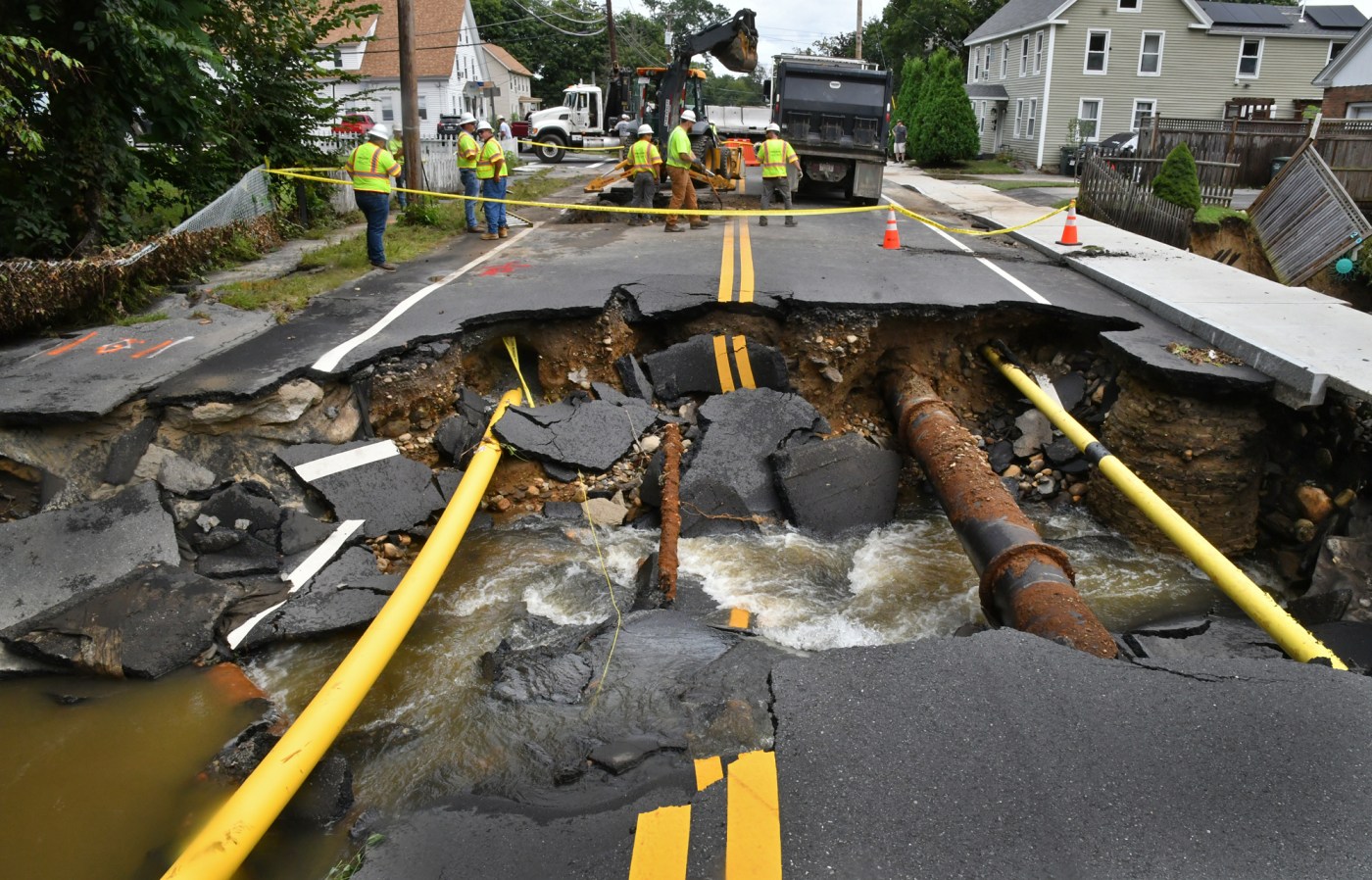
On Sept. 11, a storm system brought scattered thunderstorms and widespread flash flooding to the region, especially in Leominster. Up to 9 inches of rain fell in a short time. There were many streets closed, cars stranded in flood waters, and several houses with flooded basements or first floors.
Hurricane Lee then passed offshore on Sept. 15 and 16, with its winds causing tree damage. There was also minor coastal flooding and erosion.
The final big storm of the year was a week before Christmas, as strong winds knocked out power for hundreds of thousands of Bay State households. Blue Hill Observatory in Milton had the highest recorded wind gust of 90 mph. More than 4 inches of rain fell in spots.
Overall, it was a pretty warm year. Boston’s average temp was 54 degrees, making it the third warmest year on record for the city. Worcester was in line for its warmest year on record, with an average of 51.6 degrees as of Dec. 27.
Because it was so warm, snow was down for the Boston-area. Only 11.6 inches of snow fell in Boston, which was the fourth least snowy year in recorded history.
There was one extremely cold stretch, however. An arctic blast in early February brought record cold to the region. Many locations plunged into the negative teens. It was the first time Boston had reached -10 since January of 1957.
Hazy smoke from the Canadian wildfires smothered Boston at times over the summer. (Matt Stone/Boston Herald)


More Stories
Porter Jr. y Rollins guían a Bucks a victoria 111-94 sobre Pacers
INDIANÁPOLIS (AP) — Kevin Porter Jr. anotó 24 puntos, Ryan Rollins consiguió 23 y los Bucks de Milwaukee, en su...
More than a third of states sue HHS over a move that could curtail youth gender-affirming care
NEW YORK — A coalition of 19 states and the District of Columbia on Tuesday sued the U.S. Department of...
Giddey y White ayudan a Bulls, que remontan déficit de 10 puntos y vencen a Hawks 126-123
ATLANTA (AP) — Josh Giddey logró 19 puntos, 15 asistencias y 11 rebotes, Coby White encestó un tiro libre decisivo...
Preds spoil Minnesota’s holiday party with OT win
The holidays can be a time of great stress. But for the Minnesota Wild, the next few days will bring...
Flagg anota 33 puntos, Davis suma 31 y Mavericks superan a Nuggets 131-130
DALLAS (AP) — Cooper Flagg sumó 33 puntos, nueve rebotes y nueve asistencias, en tanto que Anthony Davis aportó 31...
Timberwolves vencen por primera vez a Towns en triunfo 115-104 sobre Knicks
MINNEAPOLIS (AP) — Anthony Edwards anotó 38 puntos para ayudar a los Timberwolves de Minnesota a vencer por primera vez...