
Winter storm dumps snow, rain across southern New England
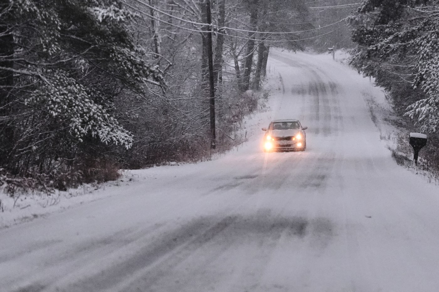
A winter storm dumped snow across western Massachusetts and New Hampshire and a wintery mix in some spots further east Tuesday, as forecasters continued to warn drivers to be cautious during the evening and morning commutes.
“The worst wintery conditions right now are more or less west of I-495 as a rough approximate, with conditions the most wintry,” said National Weather Service lead meteorologist Andrew Loconto.
Snowy conditions through Tuesday hit New Hampshire and more western areas in Massachusetts, with the highest snow accumulation of about six inches reported in Sullivan County, New Hampshire as of just before 5 p.m., Loconto said.
With hours of accumulation still to go Tuesday evening, drivers faced slippery roads and a precarious commute home, especially across the western and central parts of Massachusetts, the meteorologist said. NWS issued a travel warning north of I-90, especially near and north of Route 2.
Massachusetts Department of Transportation reduced the speed limit to 40 mph on I-90 from the New York state line to mile marker 59 in Ludlow early Tuesday. New Hampshire also saw speeds reduced for the storm on several roads Tuesday, including parts of I-89, I-93, and the Everett Turnpike and all of I-293 and NH-101.
The eastern part of Massachusetts saw temperatures remain above freezing Tuesday afternoon, keeping precipitation rainy over areas like Boston through the evening commute.
Temperatures were expected to fall Tuesday night, allowing for period of “wet, greasy snow” in more eastern Massachusetts towns.
“It won’t be until about 10 p.m. or so until Boston starts to see like some some wet accumulations,” said Loconto. “But that should be minor, and by far the worst of the conditions are still going to be in interior portions of central and western Massachusetts.”
Areas like Boston, Norwood, Brockton, Mansfield and Taunton may see up to half an inch of snow, Loconto said.
In Massachusetts, spotters reported snow accumulation totals pile up out west towards the Berkshires, with up to 4.1 inches in Ashburnham, 4 inches in Ludlow, and 4 inches in Southhampton as of just before 5 p.m., according to NWS. Worcester County in general saw accumulations between two and four inches, Loconto said.
“Much of New Hampshire is dealing with probably quite a bit more snow than we are,” said Loconto. … “Up there, a general three to five inches has been pretty common.”
Tuesday’s weather may be a good start to ski season in the area, the meteorologist said, with temperatures dropping well below freezing over the next few days.
“The next couple days, it’s going to be pretty chilly,” said Loconto. “Even by Friday, we have high temperatures that are in the 20s. Temperatures are gonna be good for snowmaking, using their snow guns. So this would be good conditions for them as far as skiing goes.”
For the Wednesday morning commute, Loconto said he wouldn’t anticipate widespread issues like a black ice problem but there could be some slippery patches on the roads.
“If there are any slippery spots, it’s probably more into the interior portion of southern New England, but I would imagine the roads have been treated pretty effectively,” said Loconto. “But I wouldn’t rule out there being some slippery spots.”
Related Articles
Heavy snow predicted for Northeast as Midwest still struggles with Thanksgiving weather snarls
Massachusetts snowstorm: Which areas could see more than 6 inches of snow?
Boston Weather: Tuesday snowstorm to hit Massachusetts [+see snow prediction]
A tornado damages homes near Houston as rain falls in the South and snow comes down in the Midwest
Boston Weather: Chilly, sunny Thanksgiving upcoming, no travel impacts forecast
The Massachusetts State Police said there were no crashes or incidents of note on state roads during the storm as of just after 5 p.m. Tuesday.
“The State Police encourages drivers to take care when traveling in snow or icy conditions,” MSP advised. “For your safety, please wear a seatbelt, respect the Commonwealth’s hands free laws, and leave extra time in your journey.”
This pumpkin display in Haverhill was frosted with snow by the season’s first winter storm on Tuesday, December 2, 2025. (Todd Prussman/Boston Herald)


More Stories
Oracle sheds 21,000 jobs in a year as AI rewrites the payroll
Oracle has cut around 21,000 roles worldwide over the past year, a stark sign of how quickly artificial intelligence is...
Getty opens its archive to ChatGPT as OpenAI deal sends shares soaring
One of the world’s largest photography agencies has struck a multi-year licensing agreement with OpenAI, a remarkable turn for a...
Silicon Valley money lands on British AI certifier as John Doerr backs isometric
The Silicon Valley investor John Doerr, an early backer of Google and Amazon, has written the second-largest cheque in a...
StubHub stung for nearly £900k as the CMA cracks down on hidden ticket fees
Ticket resale platform StubHub has been fined just under £900,000 and ordered to repay more than 50,000 customers after the...
Small firms can buy ITV, Sky and Channel 4 airtime in minutes as Universal Ads launches in the UK
For decades, television advertising has been the preserve of brands with deep pockets and a media agency on retainer. From...
GMB warns MPs cost of not saving British Steel would have been ‘unfathomable’
The cost of allowing steelmaking in Scunthorpe to collapse would have been “unfathomable”, the GMB union has told MPs, as...