
Hurricane Helene’s toll: 1.2 million without power in Florida, at least three dead
Hurricane Helene made landfall in Florida overnight near the mouth of the Aucilla River in the Big Bend area as a massive Category 4 storm, bringing a nightmare storm surge just 20 miles from where similarly sized Hurricane Idalia came ashore last year around this time and caused widespread damage.
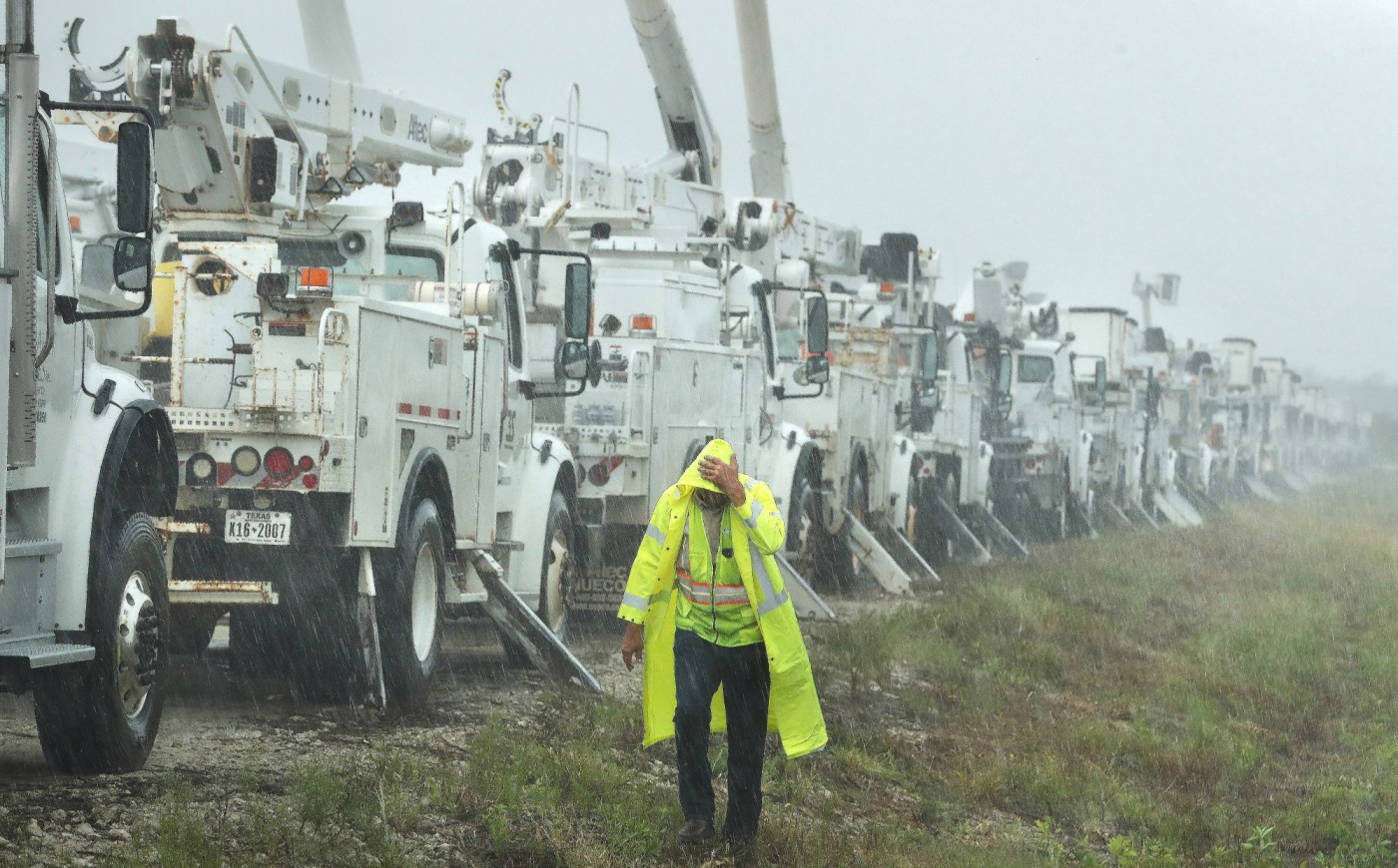
Across Florida, Helene has left more than 1.2 million homes and businesses without power as of early Friday morning. At least three storm-related deaths have been reported, but the full extent of the destruction won’t be clear until the sun breaks.
As of 5 a.m. Friday, Helene was downgraded to a tropical storm about 100 miles southeast of Atlanta.
The “extremely dangerous” storm in a matter of hours Thursday strengthened from a Category 2 into a Category 4 hurricane and maximum sustained winds reached 140 mph when it made landfall, the National Hurricane Center said.
This satellite image shows Hurricane Helene’s eye wall approaching landfall in Florida at 10 p.m. ET on Thursday, Sept. 26, 2024. (NOAA/GOES-East/TNS)
Helene had one of the largest wind fields of any storm to hit the southeast U.S. in years, according to Colorado State University hurricane researcher Phil Klotzbach, who said that since 1988, only three Gulf hurricanes were bigger than Helene’s predicted size: 2017’s Irma, 2005’s Wilma and 1995’s Opal.
One person was killed in Florida when a sign fell on their car and two people were reported killed in a possible tornado in south Georgia as the storm approached.
“We’re going to be waking up to a state where very likely there’s been additional loss of life and certainly there’s going to be loss of property,” Florida Gov. Ron DeSantis said at a news conference Thursday night.
Even before landfall, the storm’s wrath was felt widely, with sustained tropical storm-force winds and hurricane-force gusts along Florida’s west coast. Water lapped over a road in Siesta Key near Sarasota and covered some intersections in St. Pete Beach. Lumber and other debris from a fire in Cedar Key a week ago crashed ashore in the rising water.
Gov. Ron DeSantis urged people to remain at home or shelter in place until the storm completely passed and daylight breaks.
By about 10 p.m., reports of coastal and street flooding began in downtown Tampa; downtown Fort Myers; Anna Maria Island; Bradenton; Cedar Key; Matlacha, near Cape Coral in Lee County; Marco Island, south of Naples; and Vanderbilt Beach, in Naples. Parts of Clearwater Beach in the Tampa Bay area were inundated by about 9 p.m., according to the hurricane center. The Florida Division of Emergency Management said on X that the entire west coast was seeing significant surge and street flooding from Helene.
On Clearwater Beach, a NOAA National Ocean Service tide gauge reported a water level of 6.18 feet above mean higher high water. In Cedar Key, a tide gauge reported a waterlevel 5.76 feet above mean higher high water.
Bradenton Police posted a video on X shortly after 8 p.m. of a causeway that showed strong winds whipping and waves rolling in over the road lanes. Lee County Sheriff Carmine Marceno posted a video on X shortly before 8:30 p.m. that showed marine deputies pushing a small rescue boat through moving water, “preparing for a rescue along Fort Myers Beach.” The Pinellas County Sheriff’s Office posted a video on X about 6:30 p.m. that showed waves crashing over walls off the beach at Indian Shores.
Water beginning to come over walls off the beach in Indian Shores. Also, as the sheriff said earlier…someone is gonna “win a stupid prize…” #HurricaneHelene pic.twitter.com/jLISw266dt
— Pinellas County Sheriff’s Office (@SheriffPinellas) September 26, 2024
The Palma Sola Causeway is CLOSED. Water over road, loose sailboat, and multiple trees down. #Helene pic.twitter.com/NDI8IZth6Z
— Bradenton Police Department (@BradentonPD) September 27, 2024
Helene was expected to bring a deadly storm surge as high as 20 feet above ground level in parts of the Panhandle, from Carrabelle to Suwannee River. The National Weather Service called the forecast “a nightmare surge scenario for Apalachee Bay.”
DeSantis said there were reports of one fatality, when a sign fell on a car on Interstate 4 in Ybor City. In Georgia, the sheriff’s office in Alamo reported two people were killed in a possible tornado spawned by Helene.
Storm surge warnings remained in effect Thursday evening from Mexico Beach eastward and southward to Flamingo south of Everglades National Park, including Tampa Bay and Charlotte Harbor.
While wind can tear off roofs, knock down trees and snap power lines, storm surge can push buildings completely off their foundations, can trap and even drown people in their homes, wash out roads and bridges, toss boats inland and hammer anything in its path.
“The leading cause of death from hurricanes is water, not wind,” said Craig Fugate, the former director of the Federal Emergency Management Agency.
Helene aimed at the sparsely-populated Big Bend area, where rain began to blow in Thursday morning along coastal U.S. Highway 98, which winds through fishing villages and vacation hideaways in this region where Florida’s Panhandle and peninsula meet. Shuttered gas stations dotted the two-lane highway, their windows boarded up with plywood.
Mandatory evacuation orders stretched from the Panhandle south along the Gulf Coast in low-lying areas around Tallahassee, Gainesville, Cedar Key, Lake City, Tampa and Sarasota.
Officials in mostly rural Taylor County, which has a population of about 22,000, offered a very dire warning on Facebook for anyone who didn’t evacuate: “Please write your name, birthday, and important information on your arm or leg in a PERMANENT MARKER so that you can be identified and family notified.”
The sheriff’s office further asked residents to email them vital information including the location of their home, and the number of people and animals who live there.
They also asked residents who followed evacuation orders to have patience when it’s time to return home. They noted that there will likely be many impassable roads, downed trees and power lines.
The Big Bend stretch of Florida known as the Forgotten Coast has been largely spared by the widespread condo development and commercialization that dominates so many of Florida’s beach communities. The sparsely populated region is loved for its natural wonders — the vast stretches of salt marshes, tidal pools and barrier islands; the dwarf cypress trees of Tate’s Hell State Forest; and Wakulla Springs, considered one of the world’s largest and deepest freshwater springs.
As Big Bend residents prepared their homes, many saw the ghost of 2018’s Hurricane Michael. That storm rapidly intensified and crashed ashore as a Category 5 that laid waste to Panama City and parts of the rural Panhandle.
Two big universities — Florida State and FAMU — were deserted, closed due to the impending hurricane. A refuge center for students had been set up at the Donald L. Tucker Civic Center nearby. Students who remained in the dorms at Florida State University and Florida A&M University in Tallahassee were moved into shelters for the duration of Hurricane Helene.
Many Tallahassee residents — even veterans of past hurricanes like Hermine and Michael — chose to leave rather than ride out another storm, especially one that all forecasts said had the potential to become a major hurricane with devastating winds and lacerating rains that would likely trigger flash flooding.
“All signals of it being devastating and the trajectory wavering made me reach a decision point, especially with an elderly cat with kidney disease,” said Jeff VanderMeer, a popular science fiction author and longtime resident. “This storm has rattled a lot of people who never left before. I think a lot of it is exhaustion and the uncertainty of the spaghetti models offering alternate realities … and the erratic nature of the storm. It’s psychological, too.”
Tallahassee-area Waffle House restaurants were closed, not a good sign since it is known as the last place to shut during an approaching storm. The restaurant chain’s resistance to closing is so reliable that the Federal Emergency Management Agency has adopted a Waffle House Index as a barometer of how bad things are locally.
As of 9 p.m. Thursday, there were 445,000 customers without power across the state.
DeSantis said power could return as quickly as it did when Hurricane Idalia struck nearby last year, but it depends on whether there is a “structural disruption” on top of damaged power lines, such as during Ian, which can leave people without power for much longer.
Hurricane and tropical storm warnings continued Thursday evening to encompass nearly the entirety of Florida, including Palm Beach, Broward and Miami-Dade counties.
Rough conditions are seen in Deerfield Beach as winds from Hurricane Helene churn the water on Thursday. (Joe Cavaretta/South Florida Sun Sentinel)
Isolated tornadoes remained possible for South Florida overnight, and the risk of flooding rain for the region will continue through Friday.
Hurricane Helene impact
President Joe Biden declared a state of emergency in Alabama on Thursday. The governors of Florida, Georgia, the Carolinas and Virginia already declared emergencies in their states.
Heavy rains began falling and winds were picking up in Valdosta, Georgia, near the Florida state line. The National Weather Service said more than a dozen Georgia counties could see hurricane-force winds exceeding 110 mph.
The National Weather Service said northern Georgia, the Carolinas and eastern Tennessee are likely to see historic levels of flooding from Helene’s rains.
Northern Georgia, the Carolinas and eastern Tennessee are likely to see historic levels of flooding from Helene’s rains. The weather service in Greenville-Spartanburg, South Carolina, said in a post on X that there will be record flooding.
*URGENT MESSAGE*
This will be one of the most significant weather events to happen in the western portions of the area in the modern era. Record flooding is forecasted and has been compared to the floods of 1916 in the Asheville area. pic.twitter.com/Q8SmJUlQda
— NWS GSP (@NWSGSP) September 26, 2024
Parts of the southeastern U.S. and into the southern Appalachians will see between 6 to 12 inches of rain from Helene, possibly up to 20 inches in some isolated areas, the NHC said.
“Considerable to locally catastrophic flash and urban flooding is likely for northwestern and northern Florida and the Southeast through Friday,” the hurricane center said.
For Atlanta, Helene could be the worst strike on a major Southern inland city in 35 years, said University of Georgia meteorology professor Marshall Shepherd.
Live webcams: Watch Hurricane Helene’s impacts on Florida coast
Parts of South Florida recorded wind gusts between 49 and 72 mph on Thursday as Helene’s strong outer bands moved through the region, according to the National Weather Service Miami.
Many school districts and universities in the state closed campuses and government offices and buildings will be closed in many counties. The University of Florida will remain closed through Friday.
After Broward and Palm Beach County schools closed Thursday; all will resume normal operations Friday. Schools remained open in Miami-Dade County. Broward College, Florida Atlantic University and Palm Beach State College will all reopen Friday.
Florida Highway Patrol closed the Skyway Bridge, which crosses Tampa Bay, and the Howard Frankland Bridge due to strong winds from Helene Thursday afternoon.
Airports across the state closed or suspended operations. Tallahassee International Airport, Gainesville Regional Airport, Tampa International Airport and St. Pete-Clearwater International Airport have all suspended services. Some airlines have cancelled traffic to Southwest Florida International Airport in Fort Myers.
Orlando International remained open, as did Miami International, Fort Lauderdale-Hollywood International, and Palm Beach International, but travelers are advised to check with their airlines or the travel service Flight Aware for possible delays or disruptions.
Amtrak’s Silver Star and Silver Meteor routes, from New York to Miami, will originate and terminate in Jacksonville.
Meanwhile, Tropical Storm Isaac is forecast to become a hurricane within days, although it will be no threat to land.
As of 5 p.m. Thursday, Isaac was 880 miles east-northeast of Bermuda with maximum sustained winds of 50 mph, moving east at 10 mph. Tropical-storm-force winds extend up to 60 miles from the storm’s center. It is expected to move east to east-northeast over the open waters of the Atlantic.
Sun Sentinel staff writer Robin Webb and Orlando Sentinel staff writer Jeffrey Schweers contributed to this report, which was supplemented by information from the Associated Press and Fresh Take Florida.
This is a developing story, so check back for updates. Click here to have breaking news alerts sent directly to your inbox.


More Stories
600 global investors head to Farnborough with capital to let fly
More than 600 senior investors from around 350 firms, including Goldman Sachs, Blackstone and the Qatar Investment Authority, will descend...
Top 8 Creative Corporate Retreat Ideas for Team Building on Any Budget
Slack pings can’t replace real face time. That’s why 85 percent of employees say off-sites deepen their connection to company...
Brown and pleasant land: will 2026 out-drought 1976 for UK farmers?
At six o’clock on Sunday morning I was standing on what used to be my lawn, decanting a washing-up bowl...
Festivals get longer licences and red tape cut in £45m music plan
The small businesses behind Britain’s live music industry have been handed a rare piece of good news, as the government’s...
$300 a kilo: space cargo costs falling faster than steam ever did
Sending cargo into orbit is getting cheaper faster than shipping freight did during the steamship revolution of the 1800s, and...
EU buying record Russian LNG volumes with total ban looming – FT
The bloc absorbed nearly all of the Yamal project’s output months before a 2027 import ban is due to take...