
St. Paul awaits ‘major flood stage’ river crest of about 20 feet Friday; Stillwater prepares for Sunday crest
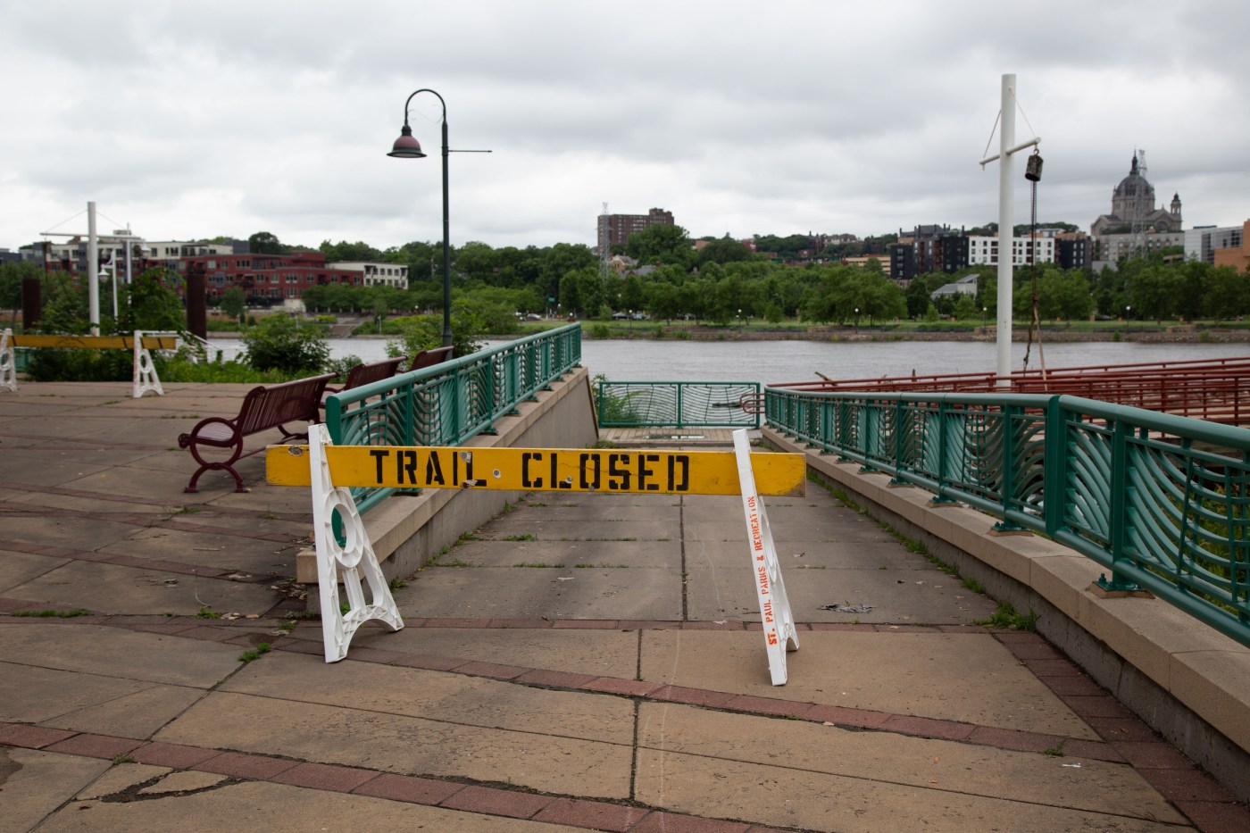
In downtown St. Paul, the Mississippi River was measuring 15 feet on Monday morning and is expected to crest around 20 feet on or about Friday — well into “major flood stage” — submerging low-lying areas in Harriet Island Regional Park and other parts of the city. The river last crested at 20 feet in March 2019.
“Models have moved down a tad since last week due to less rain than expected over the weekend, but … the hydrograph is still showing a crest at 20 feet on or around Friday,” said Clare Cloyd, a spokesperson for St. Paul Parks and Recreation.
In anticipation of river flooding, St. Paul officials closed a 3-mile stretch of Shepard/Warner Road on Sunday evening and have taken other precautionary measures at parks, trails and low-lying areas. Some one-way street segments downtown that normally connect to Shepard Road have been closed to through-traffic and converted to two-way traffic for local access to buildings. Temporarily closing Shepard Road/Warner Road is part of the city’s official flood response plan when rising river levels near the “moderate flood stage” of 15 feet. Major flood stage is reached at 17 feet.
In addition to street closings announced last week, Fourth Street between Willius Street and Commercial Street is now closed, and Childs Road will close at 9 a.m. Tuesday.
“We don’t anticipate any impact to the new construction areas along Harriet Island, but are monitoring and our (Department of Safety and Inspections) staff has made rounds of in-person contact, and frequent written communication updates to property owners along the floodplain on both sides of the river,” Cloyd said.
The St. Croix River at Stillwater
Meanwhile, the St. Croix River was at 685.1 feet in Stillwater on Monday afternoon; minor flood stage is 687 feet. The river is set to crest in Stillwater at 9 a.m. Sunday at 687.8 feet, which is just under moderate flood stage, according to the National Weather Service.
Mayor Ted Kozlowski said he and other city officials are “keeping their eyes on the sky at this point.”
“We could get more rain tonight,” he said. “It could be nothing. There’s just so much uncertainty. Any precipitation at this point is just going to extend the flood situation.”
No volunteers are needed to help prepare sandbags to reduce floodwater damage, he said, “but we’re only a 3-inch rain event from potentially needing some.”
For updated information on the Mississippi River at St. Paul go to water.noaa.gov/gauges/STPM5 For information on the St. Croix River at Stillwater go to water.noaa.gov/gauges/stlm5.
Top recorded river crests for Mississippi River at St. Paul
If and when the Mississippi River surpasses 19.02 feet at downtown St. Paul, it will be a top 10 historic recorded crest for the city. The No. 1 spot was achieved on April 16, 1965 when the river crested at 26.01 feet. For more information go to StPaul.gov/flood.
Here’s how the 20-foot forecasted crest compares to past historic levels recorded in St. Paul:
• 26.01 feet on 04/16/1965.
• 24.52 feet on 04/15/1969.
• 23.76 feet on 04/18/2001.
• 23.20 feet on 04/30/2001.
• 22.37 feet on 04/13/1997.
• 22.02 feet on 04/16/1952.
• 20.19 feet on 03/31/2019.
• 20.13 feet on 06/26/2014.
• 19.15 feet on 06/26/1993.
• 19.02 feet on 03/29/2011.
Related Articles
What’s causing the devastating flooding in the Midwest?
Minnesota officials address emergency response to ‘unprecedented’ flooding
Minnesota falls to 19th in education in state ranking
Midwest flooding collapses Iowa rail bridge, forces evacuations and kills at least 1
Minnesota National Guard mobilized to assist with flooding in south-central region

More Stories
Workplace sickness scheme branded ‘teaspoon solution’ as experts warn government plan lacks scale
A new government scheme aimed at tackling long-term workplace sickness has been dismissed by business leaders and advisers as woefully...
US offers Ukraine 15-year security guarantee as part of peace plan, Zelenskyy says
By ILLIA NOVIKOV, Associated Press KYIV, Ukraine (AP) — The United States is offering Ukraine security guarantees for a period...
US offers Ukraine 15-year security guarantee as part of peace plan, Zelenskyy says
By ILLIA NOVIKOV, Associated Press KYIV, Ukraine (AP) — The United States is offering Ukraine security guarantees for a period...
Today in History: December 29, Ghislaine Maxwell convicted
Today is Monday, Dec. 29, the 363rd day of 2025. There are two days left in the year. Today in...
Festive filers sleigh their Self Assessment returns as thousands log on over Christmas
Thousands of taxpayers chose to spend part of their Christmas break tackling their tax affairs, with more than 4,600 people...
‘Made in Britain’ body challenges Reform UK over alleged unauthorised logo use
The manufacturing trade body Made in Britain has raised concerns over the alleged unauthorised use of a logo closely resembling...