Boston Celtics parade weather forecast as heat wave ends: Temps in the 80s, chance for rain and thunderstorms
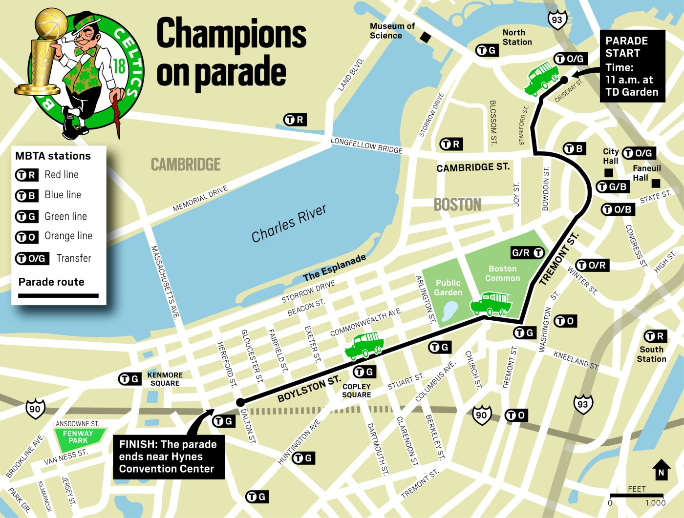
The heat will finally be gone as Celtics fans line the championship parade route, but it’s still going to feel quite sticky out there during the victory celebration on Friday.
The heat wave is thankfully ending for the Boston-area, as city temps during the parade will be cooler in the low 80s. The humidity won’t be as oppressive, but dewpoints will still be muggy in the 60s.
The National Weather Service is also forecasting a chance for rain and thunderstorms in the city.
“Spectators should be aware of the chance for showers and thunderstorms to develop in the early afternoon, and could continue into the evening,” said Torry Dooley, a meteorologist with the National Weather Service’s Boston office.
Thursday was the final day of the mid-June heat wave for the Boston-area, as temps spiked into the 90s and it felt like it was over 100 degrees.
The high temp in Boston was 97 degrees, which was just shy of the city’s June 20 daily record of 98 degrees from 1953. The heat index soared to 106 degrees.
On Wednesday, the 98 degrees reported at Boston Logan International Airport broke the daily high temp record of 96 degrees, which had been set on June 19, 1923. The heat index jumped to 108 degrees when the high temp hit 98 degrees.
“Many are wondering what caused the temp to spike to 98F in Boston today for a very short period of time,” NWS Boston posted on Wednesday. “Notice that winds went due W, compared to SSW, allowing a hotter airmass to move over the airport! Temps cooled back to around 93F as soon as the wind shifted back to the SSW.”
Related Articles
Boston smashes high temp record, 108 heat index, as ‘dangerous heat’ peaks in Massachusetts
Massachusetts beaches closed amid brutal heat wave, Walden Pond beach ‘underwater’
Massachusetts faces brutal heat wave, may feel like 106 degrees; Michelle Wu declares heat emergency for Boston
‘Heat dome’ high-pressure system could bring record breaking temps to Northeast
Massachusetts could see severe storms before intense heat wave likely: ‘Potentially dangerous heat’
Then on Thursday, there was a threat of severe thunderstorms with strong winds and torrential rain amid the intense heat and humidity.
A backdoor cold front will finally move in on Friday to break the heat.
“It’s definitely going to be cooler in the city of Boston,” Dooley said ahead of the parade. “There will be an onshore wind because of the backdoor cold front.”
Over the weekend, scattered thunderstorms will be possible each day, as well as Monday — with the best chance for storms coming each afternoon and early evening.
Temps are expected to dip into the 70s on Saturday before temps jump back into the mid-80s on Sunday and Monday.
A much more comfortable airmass should develop behind a cold front late Monday. The cold frontal passage will usher in a much drier period for the middle of next week.
A participant dressed as a king, jumps off The Denis Sullivan into the harbor Thursday to benefit the World Ocean School. (Matt Stone/Boston Herald)

